The Topography of Minoan Peak Sanctuaries
1. The Annual of the British School at Athens
Additional services for The Annual of the British School at Athens:
Email alerts: Click here
Subscriptions: Click here
Commercial reprints: Click here
Terms of use: Click here

2. The Topography of Minoan Peak Sanctuaries
A. A. D. Peatfield
The Annual of the British School at Athens / Volume 78 / November 1983, pp 273 - 279
DOI: 10.1017/S0068245400019729, Published online: 27 September 2013
Link to this article: http://journals.cambridge.org/abstract_S0068245400019729
2.1. How to cite this article:
A. A. D. Peatfield (1983). The Topography of Minoan Peak Sanctuaries. The Annual of the British School at Athens, 78, pp 273-279 doi:10.1017/S0068245400019729
Request Permissions : Click here
3. THE TOPOGRAPHY OF MINOAN PEAK SANCTUARIES
MOUNTAINTOP shrines are common to the religions of many cultures, but in Bronze Age Greece they appear to be limited to Minoan Crete; none has yet been positively identified in Mycenaean Greece or the Cyclades.1 The purpose of this paper is to examine the topographic position of Minoan peak sanctuaries, that is, their numbers, distribution, proximity to, and relationship with nearby settlements, and finally to consider the apparent change in these patterns that occurs after LM I.
More than fifty sites are presently claimed as peak sanctuaries all over Crete.2 Included with this paper is a distribution map of fifty-two sites (FIG. 1). The sites listed are based on Faure's identifications and Rutkowski's own lists,3 with some additions and deletions based on later research.4 There is no reason to suppose that the work of identification is at an end; one day the gaps in the distribution map will be filled, and all major Minoan settlements will have their own peak sanctuaries. At present the map shows the greatest proportion of sites grouped in the mountainous region of east Crete. Both Faure and Rutkowski have suggested that it was in Sitias that peak sanctuaries originated.5 Faure notes the presence of EM III sherds on these eastern peak sanctuaries.6 Rutkowski, however, shows that almost all peak sanctuaries come within the altitude regions associated with the summer transhumance of sheep and goats. The link between peak sanctuary cult and pastoral farming is also strongly demonstrated by the vast numbers of votive clay figurines of domestic farm animals. East Crete is a predominantly pastoral region; so Rutkowski argues: 'peak sanctuaries came into existence mainly to relieve the fears and cares of the shepherds and cattle breeders'.7
Faure's arguments from the EM III sherds should be treated with some caution; such pottery continued to be used in east Crete as MM I pottery was introduced and used elsewhere. The large number of peak sanctuaries in Sitias may have less to do with chronology and more
This paper is adapted from a dissertation submitted to the University of London in 1980 as partial fulfilment of an M.A. degree in Aegean Archaeology. The dissertation was a study of Minoan peak sanctuaries based primarily on the published sources. My research is continuing with a doctoral thesis examining all available evidence for Minoan rural shrines; that is, peak sanctuaries, sacred enclosures, and cave shrines. I wish to thank the many archaeologists who have helped me; particularly I am indebted to my supervisor, Professor J. N. Coldstream, and to Professor Bogdan Rutkowski for their advice and encouragement. In addition I am grateful to my fellow student Christine Morris for reading through my script and for help with the distribution map.
1 Possible sites such as the Mycenaean shrine at Apollo Maleatas near Epidaurus or Troilus on Kea may strictly be classed as hill shrines, but they do not reflect the same cult system as the Minoan peak sanctuaries that I argue for here.
2 The first sites to be investigated and classed as peak sanctuaries were Petsopha and Iouktas, published respectively in BSA 9 (1902-3) 356-87 and PM 1 (1921) 153-9. Even Platon's general study in KrChron 5 (1951) 96-160 only identified eleven sites. Since 1956, however, Paul Faure's field-work has identified more than fifty possible peak
sanctuaries. See BCH 80 (1956) 95-103; 82 (1958) 485-515; 84 (1960) 189-220; 86 (1962) 36-56; 87 (1963) 493-508; 89 (1965) 27-63; 91 (1967) 114-150; 93 (1969) 174-213; 96 (1972) 389-426; 102 (1978) 629-40. Faure's surveys have been followed up by the excavations of Davaras. The latter's excavations of many sites is complemented by Mrs. A. Karetsou's long-term excavation of Mt. Iouktas; see PAE (1974) onwards. Rutkowski's general study of peak sanctuaries, Cult Places in the Aegean World (1972) 152-88, came a little too early to include the work of Davaras and Karetsou. Nevertheless, his work provides a solid foundation for all future study of Minoan shrines; many of his conclusions have been confirmed by the later excavations.
3 Rutkowski, op. cit. 321-3.
4 In my thesis I shall reassess evidence for the claimed sites and from that produce a revised catalogue and distribution map. In the key to the map here I have asterisked the sites which I feel to be definite or probable peak sanctuaries.
5 Faure, BCH 93 (1969) 174-213, 96 (1972) 389-426 passim; Rutkowski, op. cit. 184-5.
6 Faure, BCH 96 (1972) 402.
7 Rutkowski, op. cit. 185.

Key. 1. Vigla, Ayia Triadha: Sitias. 2. Perivolakia: Sitias. 3. Etiani Kephala: Sitias.* 4. Ai Ilia: Sitias. 5. Xykephalo: Sitias.* 6. Vigla Zakrou: Sitias.* 7. Plagia: Sitias.* 8. Korphi tou Mare: Sitias.* 9. Ambelos: Sitias.* 10. Gorge of the Dead, Kato Zakro: Sitias. 11. Traostalos: Sitias.* 12. Zou/Prinias: Sitias.* 13. Modhi: Sitias.* 14. Petsophas: Sitias.* 15. Kalamaki: Sitias.* 16. Lastros: Sitias. 17. Volakas: Ierapetras. 18. Thylakas: Mirabello.* 19. Karphi: Lasithi.* 20. Kراسi: Pedhiadha. 21. Arkovouno: Mirabello. 22. Prophitis Elias, Mallia: Pedhiadha. 23. Entichti Mochos: Pedhiadha. 24. Maza: Pedhiadha.* 25. Smari: Pedhiadha.* 26. Roussos Dhetis: Viannos.* 27. Dhernati: Monophatsi. 28. Choudhetsi: Pedhiadha. 29. Iouktas: Temenos.* 30. Ai Lias: Monophatsi. 31. Koumasa: Monophatsi. 32. Linarou Selli: Monophatsi. 33. Kophinas: Monophatsi.* 34-8. Ayiopharango Valley: Kainourio. 39. Pobia: Kainourio.* 40. Krousonas: Malevisi. 41. Keria: Malevisi.* 42. Gonies: Malevisi.* 43. Pyrgos: Malevisi.* 44. Ayia Apakoe: Mylopotamos. 45. Grivigla: Mylopotamos. 46. Vrysinas: Rethymnon.* 47. Angouscliana: Ayios Vasilios. 48. Drapanokephalo: Apokoronas.* 49. Zourva (nr. Aptera): Apokoronas. 50. Sklokas: Kydonias.* 51. Onychas Rodhopou: Kissamos. 52. Chesmeni Gramvoussa: Kissamos.
to do with the development of the settlement pattern in that region. In simple terms, Sitias consists of a series of mountain ridges, which are separated by small valleys. These valley plains can be quite fertile, watered by the springs from the mountains that enclose them; settlements, therefore, ancient and modern, are scattered along them. These mountains can also give access to high upland plains suitable for summer pasturage. Consequently, we have a pattern of small communities, made up of one or more settlements within a small valley. Overlooking each valley is the highest peak of the enclosing mountain ridge. In short, the landscape, with its contrasting small valleys and dominating peaks, is particularly suited to the spread of mountain shrines.
The altitude of peak sanctuaries varies considerably. Generally, the lowest are around 200 m, e.g. Petsopha at 215 m. At the other end of the scale sanctuaries are also found at over 1000 m, e.g. Karphi at 1148 m, Kastellos at 1160 m, Keria at 1168 m. Despite this huge difference in altitudes Rutkowski has pointed out that all peak sanctuaries fall within certain vegetation zones.8 Referring to the work of Philippon,9 Rutkowski has shown that all peak sanctuaries, irrespective of height, are associated with altitude regions that allow for some sort of farming, arable or pastoral, often both. Therefore, today, routes up to the summit pass through vineyards and groves of olive and fruit trees; they climb past mountain meadows of fragrant herb bushes where bees gather nectar, and sheep and goats graze in summer. Indeed, it is striking just how many peak sanctuaries have a gentle slope on one side of the summit, or a high flat area below it, where flocks are still pastured today: e.g. Petsopha, Pyrgos, Vrysinas, Traostalos, Modhi, and Zou.
The Minoans obviously made this association between goats and peak sanctuaries, as shown by the agrimia on the famous stone 'peak sanctuary' rhyton from Zakro.10 Platon has suggested
8 Rutkowski, op. cit. 153-5.
9 A. Philippon, Das Klima Griechenlands (1948) 157 ff.
10 Platon, Zakros (1971) 165.
an etymology for the name Traostalos, the peak sanctuary north of Zakro; he suggests that it means 'enclosure' or 'sanctuary of goats'.11
Reference to the varying altitudes of peak sanctuaries can be misleading. It is better to speak of distance relative to the nearest settlements, as they display a remarkable consistency. Most peak sanctuaries are within reasonable walking distance even of modern villages. There is no reason to suppose that Minoan settlements and villages were further away; indeed, Faure's surveys make a point of noting Minoan remains which are usually closer than modern settlements. Throughout their work, Faure and Rutkowski state walking times from villages up to the sites. The average quoted time is about one hour. While most of these times are quite possible, it should be understood that these are the optimum times, given the most favourable circumstances—that is, reasonable fitness, knowledge of the quickest route, good weather (not too hot or too windy), etc. It is only our speed-obsessed society that measures time so precisely; so, to people for whom walking was the usual mode of transport, a leisurely climb of several hours would not have seemed a great hardship. For modern mountain chapel festivals (particularly those dedicated to Aphendis Christos on 6 August each year), many people from all over the district gather to make the pilgrimage up the mountain. Only the very old, the very young, and the sick exclude themselves, but even then few people are inclined to race up the mountain. So it seems that a more realistic definition of an average climb is one that takes several hours.
It appears then that the Minoans chose particular mountain summits for peak sanctuaries. Of the various factors which may have influenced that choice, Rutkowski has rightly emphasized accessibility and proximity to mountain pastures. Another factor appears to have been the general prominence and visibility of the chosen mountain. In the open plains height and reasonable access were most important—i.e. the highest mountain is the obvious one from which to worship the deity. For example, Vrysinas is a solitary mountain in the plain of Rethymnon; Kophinas is the highest mountain of the Asterousia range, and its peak is visible even from Phaistos at the far end of the Mesara plain. Iouktas, in turn, dominates the whole of the north central region of Crete, and its profile, like the face of a bearded man lying down (best seen from the west), can only have added to the Minoan belief in its sanctity.
In some areas, however, it is not the highest point which is chosen. Minoan Palaikastro is sited in a small coastal plain, just north of the mountain Petsopha. This mountain is a ridge, which juts out from the encircling massif. The ridge has three peaks and the sanctuary is sited on the lowest of the three; it is this peak which most directly overlooks the town. From the other summits the view is obscured by lower platforms and cliffs. Faure notes a similar situation with the peak sanctuary at Etia.12 The shrine is not on the highest peak of the massif, which is Skopeli at 715 m. Rather it is situated on an isolated butte to the north, 100 m lower down. From there, however, one can see the valley plains of Armeni and Chandra. A third example is observable at Zou.13 The summit is 803 m high, but the peak sanctuary is on the rising edge of a small plateau, north-west of the summit, at an altitude of 725 m. It is only from this high point that the coastal plain of Sitia can be seen; moreover, from the plain this point looks like the summit.
It seems important then that the sanctuary should be seen from the region it served, and also that it should 'see' that region. The reason may simply have been that the most prominent mountain is the best landmark for worshippers to travel to. We do know, however,
11 Ibid. 167.
12 Faure, BCH 91 (1967) 121.
13 Davaras calls this site Prinias, but to avoid confusion with
the Iron Age site in Central Crete, I shall follow Faure in referring to this site as Zou.
from the remains of greasy ashes on the peak sanctuaries, that sacrificial bonfires were lit; fires on mountain tops are lit to be seen, so it is pointless to place one where it could not be seen from the homes of the worshippers. In choosing a mountain with the best view, it seems that the Minoans did not attribute complete omniscience to their deities. For example, the votive figurines of humans and animals were in part, at least, intended as reminders of who and what needed to be protected; similarly, the model parts of the body showed precisely what needed to be cured. Thus, it was important also that the deity could see the area from which the faithful came.
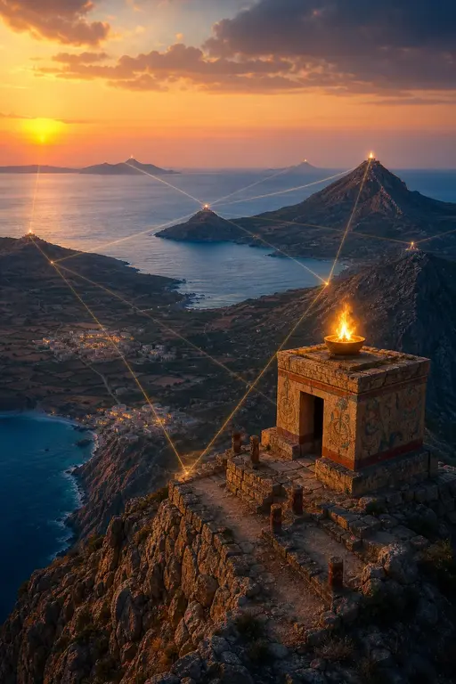
Naturally, the view from each peak sanctuary is spectacular. As noted above, the peak sanctuaries of east Crete are clustered closely together; so close that one or more other peak sanctuaries are often visible from one another. The most outstanding example of this is Traostalos; from the summit at least six other peak sanctuaries can be seen: Petsopha to the north, Modhi to the north-west, Vigla Zakrou, the tip of Plagia, and Korphi tou Mare, all to the south-west, and Ambelos to the south. A similar situation is found a little further west in central Sitias. The peak sanctuary that dominates the north central plain of Sitias is Zou. South of this mountain are several other peak sanctuaries: Ai Ilia, Xykephalo, and Etia. From all of them Zou can be seen clearly, and the eye is drawn north towards it, as the highest peak on the horizon. In the Iraklion region the same is true, as there Mt. Iouktas is the major focal point for all the other peak sanctuaries as far west as Gonia, and as far east as Karphi. In all these cases it appears that one mountain dominates not only the settlements nearby, but also the other peak sanctuaries within view.
A recent survey of the Ayiopharango valley in south Crete has shown many of these topographic features on a smaller scale.14 Within this small area the surveyors identified five small hills as peak sanctuaries: sites E4A, E12, E18, W11, MOW1. Each 'peak sanctuary' overlooks a small farmstead and associated tholos tomb. It is suggested that each of these hills was the local shrine of the family/clan who lived in the farmstead and buried their dead in the tholos. The hills are quite low and the surveyors suggested that the site E12, in the centre of the valley, may have been a focus for the whole valley community, not just the local farm. From this and other evidence Bintliff has developed the idea of a sacred hierarchy of peak sanctuaries and other shrines.15 Furthermore, using a Mexican anthropological study as a model, he goes on to suggest a 'series of ritual pilgrimages' to these shrines 'which unite ever larger units of the regional community'.16 That is to say, the people near Xykephalo and Etia would have visited not only their own peak sanctuary but also that of Zou, which dominated the whole region.
This idea of a hierarchy among the cult places is both attractive and plausible.17 Unfortunately, not all the evidence can be said to support it, in particular that of the peak sanctuary shrines themselves. While the peak sanctuaries share certain characteristics—topographic position, votive offerings, etc.—the structural remains vary greatly. On a number of sites Faure has identified walls of stones limiting a temenos area; on some there are small elliptical enclosures, while others have more elaborate multi-roomed structures with large
14 Blackman and Branigan, BSA 72 (1977) 13–84.
15 Bintliff, Natural Environment and Human Settlement in Pre-historic Greece (British Archaeological Reports, Supplementary series 28, 1977) 145–70.
16 Ibid. 151.
17 The Ayiopharango model is an inspired idea. There is, however, reason to doubt the identification of the five hill sites as peak sanctuaries. My own arguments will be fully presented
in my thesis, but briefly: the sites are chronologically too early; they are too low in relation to the high mountain walls of the narrow valley; there are no figurine finds; none of the hills is visible from any other. In consultation Professor Branigan has agreed that they do not fit the proposed definitions of Minoan peak sanctuaries, but insists that they must be shrines, perhaps some form of EM sacred enclosure.
stones incorporated as altars, etc. In contrast, most sites have no identifiable structural remains at all. This great variety seems to bear no relation at all to the suggested hierarchy of peak sanctuaries. For example, from its topographical position, Petsopha can only have been important to the town of Palaikastro. Yet it has a three-roomed structure with a cult bench and stone walls preserved up to a height of about two metres.18 Modhi and Traostalos, however, have very crude two-roomed structures delineated only by lines of stones, even though from their topographic position they should be more important in the hierarchy.19 It seems, therefore, that the individual peak sanctuaries were very local, serving only the settlements in the immediate area. Petsopha's comparative elaboration is explained by the nearness and prosperity of its town Palaikastro, whereas Modhi and Traostalos served poorer and smaller farming communities spread over larger areas.
We know from the thick layers of ash on all peak sanctuaries that large bonfires must have been lit as part of the ceremonies. From the lines of view noted above, individual bonfires would have been visible from several other peak sanctuaries. The suggested hierarchy then may not have been for a series of ritual pilgrimages, but for a network of sacred beacons which would have united various regions on a single festival night. Perhaps when the gaps in the distribution map are filled, a network of peak sanctuaries may unite all the main inhabited areas of Minoan Crete.
In whatever way a hierarchy exists, it must be assumed that Iouktas stands at the head of it. The magnificence of the architecture and quality of the finds are unparalleled at any other peak sanctuary.20 The site was in use from MM I, as the earliest finds show.21 But from MM III the shrine underwent a dramatic change; to that period are dated the first of the monumental structures and from then the votives become noticeably richer.22 It should be noted that MM III is the suggested date for the shrine buildings on other peak sanctuaries which have them.23 This date coincides with Knossos' increased control over the island and the setting up of the villa system. Rutkowski has suggested that from MM III the peak sanctuary cult became more institutionalized under Knossian royal authority, perhaps with permanent priests.24 As the peak sanctuary cult was an apparently unifying factor on Minoan society, centralized control over it could have been used politically. As Knossos was the administrative focus for all Crete, so, perhaps, Iouktas became the focal point for the peak sanctuary cult.
Most peak sanctuaries seem to come to an abrupt end soon after the close of the Middle Bronze Age. All the reports date the greater proportion of the excavated material to the Middle Minoan period; Late Minoan finds seem to be few and apparently limited to LM I. Rutkowski suggested25 that this apparent decline was due to the series of natural catastrophes that Crete suffered from MM III to LM I. The disastrous effects of the Thera eruption finally caused the people to turn from the powerless gods of the skies whence came the poisonous fall-out, and they abandoned the peak sanctuaries. As the following period sees an increase of cult activity in the caves, it is argued that the people turned to chthonic deities, who might be able to stop the earthquakes and protect the homes. Peak sanctuaries, however, were not irrevocably abandoned, as there was a small revival of the cult on a few sites late in LM III.
18 Myres, BSA 9 (1902-3).
19 Modhi: Adelt 27 (1972) B2 652; Traostalos: KrChron 17 (1963) 405-6.
20 Karetsou, PAE (1974) 228-39, (1976) 408-18, (1977) 417-42, (1978) 232-58, (1979) 280-1.
21 Karetsou, PAE (1974) pl. 179c.
22 Karetsou, PAE (1976) 408-18.
23 Those best substantiated are Petsopha, Traostalos, Modhi, Pyrgos, Gonies, Kophinas, Vrysinas, and Iouktas.
24 Rutkowski, op. cit. 186.
25 Rutkowski, 'The Decline of the Minoan Peak Sanctuaries', Atti e Memorie del I Congresso Internazionale di Micenologia (Rome 1967) i. 163-8.
The scientific papers of the Second Thera Congress26 tended to minimize the destructive effects on Crete of the earthquakes, tidal waves, and poisonous ash. The general conclusion reached was that the area and level of ashfall on Crete was far less than previously argued, and the consequent destruction less.27 This does not, however, deny that the effects were traumatic enough to elicit some religious response from the Minoans. Hood recalled votive deposits at Zakro, Palaikastro, and Nirou Chani which appear to have some connection with the Thera eruption in LM IA.28
It seems, therefore, that the decline in the number of peak sanctuaries should be more closely associated with the general decline in the number of settlements after LM IB. That there was an abandonment of settlements in east Crete then is not disputed; the cause of that abandonment is more controversial. It may have been caused by the effects of the Thera volcanic ash, or by a Mycenaean invasion, or by a combination of both factors. It has already been shown above how the peak sanctuaries were closely connected with areas of settlement. Therefore, if those settlements were abandoned, obviously their associated peak sanctuaries were also deserted.
The question of the abandonment is linked with the suggested revival of the cult in LM III. Material from this period has been identified on Angouseliana, Drapanokephala, Iouktas, Karphi, Kastellos, Kophinas, Modhi, Pobia, Smari, and Vrysinas. Of these only Modhi (for which the evidence is dubious) is in east Crete; the other sites are in parts of Crete not generally affected either by Thera in LM IA or by the abandonments of LM IB. Even the idea of an LM II interval is partly illusory, as the absence of datable, fine pottery is not a valid criterion. For the period of certain occupation (MM I-LM I) fine decorated wares have not been found on any peak sanctuary except Iouktas (so far as can be judged from the reports). LM II pottery, anyway, appears to have a limited distribution;29 it is still best known from Knossos, and the one peak sanctuary where LM II sherds have been identified is Iouktas.30
Therefore, I suggest an alternative interpretation of the decline of peak sanctuaries: the east Cretans' faith in the peak sanctuary cult was shaken, though not broken, by the natural catastrophes which hit them from MM III to LM I. The causes which led to the abandonment of their homes in LM IB naturally led to a desertion of their shrines. The decline in the numbers of peak sanctuaries did not mean a diminution of the importance of the cult. Where there was continuity of occupation, particularly at Knossos and in west and south Crete, the peak sanctuary cult also continued.
While such a theory can only be proved by a full study of the material from all the peak sanctuaries, Iouktas and Knossos do give some evidence for this. First, LM II pottery is found on Iouktas.31 Secondly, there may have been buildings in use then.32 Thirdly, the so-called 'Mountain Mother' sealing from Knossos is also dated to LM II. This sealing shows a female figure on a hill, flanked by heraldic lions. She hands a staff to a larger male figure who holds one hand to his forehead (a gesture of worship). This scene is interpreted by Rutkowski33 as the goddess of the peak sanctuaries endowing the king with her divine authority and power, to be her earthly representative. (The goddess's gesture recalls that of the authoritative figure
26 Thera and the Aegean World (1978). In particular see the article by Cita and Ryan, 'The Deep-Sea Record of the Eastern Mediterranean in the Last 150,000 Years' 45-60. This amends the earlier arguments of Ninkovitch and Heezen, 'Santorini Tephra: Submarine Geology and Geophysics', Proc. of the 17th Symposium, Colston Research Society (1965) 413-53.
27 Popham, Antiquity (1974) 58.
28 Hood, 'Traces of the Eruption Outside Thera', Thera and the Aegean World (1978) 681-90.
29 Popham, BSA 75 (1980) 163-8.
30 Karetsou, Ergon (1978) 62.
31 Ibid.
32 Ibid.
33 Rutkowski, op. cit. (1972) 173.
on the 'Chieftain' cup from Ayia Triadha.) LM II is the period of Mycenae rule at Knossos, so it may be that this sealing was intended as a piece of religious propaganda to justify that rule. However fanciful this idea may seem, the date is still significant. After all, why should the goddess be endowing anyone with anything if she had been abandoned for more powerful deities?
A. A. D. PEATFIELD